

Forecasts remain mostly unchanged, with East Baton Rouge and surrounding parishes still under an extreme cold warning and winter storm watch from Winter Storm Fern.
But it is also unclear if the Capital Region's current rainfall will have time to dry before freezing temperatures arrive Sunday evening, according to meteorologists with the National Weather Service's station in Slidell.
Rain is expected to continue through Sunday, but it remains largely unlikely that Baton Rouge will fall below the "icing line" and see freezing rain, said NWS meteorologist Christian Bannan.
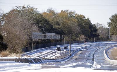
Instead, the worry is if existing water on bridges and overpasses will freeze.
"We're waiting to see how fast things dry and how fast the cold air gets here," Bannan said. "We're really not gonna be able to forecast that very well; it's gonna be just a constant watch."
The incoming north wind is a double-edged sword in this case, Bannan said, because it both dries roads and drops temperatures.
Bannan advised those needing to travel to check with the Department of Transportation's 511 line for highway condition updates.
"We will get a better idea, I think, once we start seeing the temperatures drop below freezing, that's when we'll be a little more confident in saying so," Bannan said.
Sunday's highest temperatures will come between sunrise and 10 a.m. for East Baton Rouge Parish before they drop and hold steady until sunset.
By 6 p.m., northern areas of East Baton Rouge, especially those bordering East and West Feliciana, will be close to freezing, Bannan said.
"Then, it looks like most of the Baton Rouge metro will be either below or right around freezing by 8 p.m. (Sunday) night, and it'll continue to drop all night long," Bannan said.
If water remains on bridges and overpasses by then, Bannan said "it's likely to start freezing pretty quick."
Monday morning lows will come in around the upper teens for the Felicianas, with warmer, southern areas like Ascension Parish in the mid-20s.
"If (temperatures) do get above freezing Monday, you're talking only a couple hours," Bannon said, which means the risk of frozen pipes will increase throughout the weekend.
Real danger is for anyone working or traveling outside, because temperatures will feel in the lower teens or the single digits with wind chill. Bannon said this will increase the risk of frostbite on any exposed skin.
Most parishes in the Capital Region have been under a winter storm watch since Thursday, but Bannan said the NWS has upgraded Pointe Coupee Parish and East and West Feliciana parishes to a winter weather advisory status.
President Donald Trump said Saturday he has approved a federal emergency declaration for ÂÂʧh along with several other states affected by Fern, according to a post on from his account on Truth Social.
Presidential emergency declarations address impending emergencies or disasters and are issued when the president determines federal assistance is needed to help state and local governments save lives, protect property and public safety, or avoid a catastrophe, according to the GovernorÔÇÖs Office of Homeland Security and Emergency Preparedness.
Staff writer Alyse Pfeil contributed to this story.
